
Gorges State Park
From Highlands 21 Miles: Hwy 64e To The Hwy.
281 Intersection - Head 1 mile South Down Hwy. 281 To The Park
(
On the way to Whitewater
Falls )
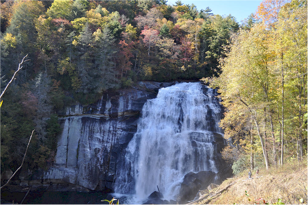
Rainbow Falls - 3 Mile Roundtrip Trail -
Strenuous - Marked w/ Orange Circles |
MAP-IT Photo By Jim
Lewicki
- Copyrighted
2017
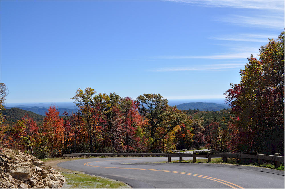
Gorges Park Roadway Photo By Jim Lewicki
- Copyrighted
2017
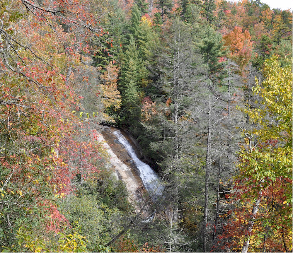
Bearwallow Falls 1 Mile Roundtrip Trail -
Strenuous - Marked w/ Blue Triangles Photo By Jim
Lewicki
- Copyrighted
2017
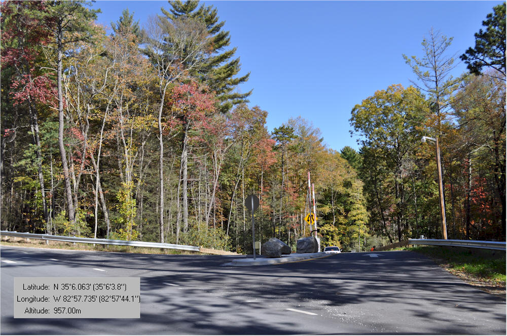
Gorges Park Entrance - Hwy. 281
MAP-IT
Photo By Jim
Lewicki
- Copyrighted
2017
WATERFALL VIDEOS
.
Bridal Veil Falls | Dry Falls | Bust Your Butt Falls | Cullasaja Falls | Glen Falls | Sequoyah Falls | Ranger Falls
Iron Bridge | Sliding Rock Cashiers | Silver Run Falls | Whitewater Falls | Rainbow Falls | Bear Wallow Falls
Looking Glass Falls | Sliding Rock Brevard | Tallulah Gorge Falls | Lake Toxaway Falls
Holcomb Falls | Ammons Falls | Overflow Creek Falls | 3 Forks Overflow Creek Falls | W. Chattooga Head
Fly Fishing - Chattooga River - Above Iron Bridge - Video